Maps And Directions
Maps And Directions > History of Maps • Map Projections
 Maps are guides or drawings that help people locate something, find travel
directions, or understand an area. There are many kinds of maps
— road maps help us find our way; topographical maps show land
elevations; geological maps show the locations of natural resources;
relief maps show landforms; thematic maps show patterns such as population
density, climate, or vegetation. Topological maps show information
without regard to correct distances or geographic attributes.
Maps are guides or drawings that help people locate something, find travel
directions, or understand an area. There are many kinds of maps
— road maps help us find our way; topographical maps show land
elevations; geological maps show the locations of natural resources;
relief maps show landforms; thematic maps show patterns such as population
density, climate, or vegetation. Topological maps show information
without regard to correct distances or geographic attributes.
Maps are generally presented with the north facing upwards, the south facing downwards, the west facing toward the left, and the east facing toward the right.
Maps use a system of longitude and latitude. Lines of latitude run across the map and are called parallels. Lines of longitude, on the other hand, run from the North Pole to the South Pole and are called meridians. While each latitude line is parallel to every other latitude line, no two lines of longitude are parallel to each other. Instead, lines of longitude are about 70 miles apart at the equator. From there they converge progressively until they come together at the two poles.
 The equator, whose latitude is zero degrees, divides the world into the
Northern Hemisphere and Southern Hemisphere. In contrast, the Prime
Meridian, which is at longitude zero degrees, divides the world into the
Western Hemisphere and the Eastern Hemisphere. The Prime Meridian
is an internationally established reference line that passes from north
to south through the Royal Greenwich Observatory in London, England.
The equator, whose latitude is zero degrees, divides the world into the
Northern Hemisphere and Southern Hemisphere. In contrast, the Prime
Meridian, which is at longitude zero degrees, divides the world into the
Western Hemisphere and the Eastern Hemisphere. The Prime Meridian
is an internationally established reference line that passes from north
to south through the Royal Greenwich Observatory in London, England.
How are lines of latitude and longitude numbered? Well, starting from the equator, each degree of latitude, which is represented by a line, is numbered to the north and to the south. These lines go as far as the North Pole, at 90 degrees North latitude, and the South Pole, at 90 degrees South latitude. Lines of longitude are similarly numbered, but eastward and westward to the 180th meridian — located on the opposite side of the globe from the Prime Meridian.
When you combine latitude and longitude, you get a grid that geographers call a graticule. The locations on a map are indicated by correctly identifying the grid coordinates on the graticule. When naming the coordinates, the latitude is given first, followed by the longitude. When the latitude is referenced, it must be specified whether the location is north or south of the equator. Similarly, when the longitude is referenced, it must be specified whether the location is east or west of the prime meridian.
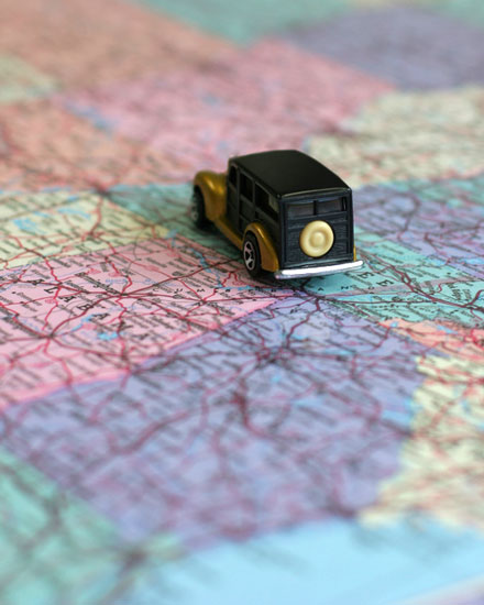
In recent years, several mapping algorithms have been developed to chart and describe the best routes to travel between geographic locations. Taking into account such factors as distance, speed limits, and traffic congestion, these sophisticated programs produce remarkably accurate results for popular driving directions sites such as Mapquest, Google Maps, Yahoo Maps, and Windows Live Local.
This site, MapsAndDirections.us, features a convenient directory of online map and driving direction resources as well as United States and World atlases. The scrollable state maps show cities and towns as well as Interstate, Federal, and State highways; they can be printed in sections and used as travel maps. The website also features an overview of map projections, including four world map examples that illustrate cylindrical and azimuthal projections.
Shop for Maps
- Maps.com
Map and travel store offers wall maps, travel maps, atlases, travel guides, globes, and more!
www.Maps.com - Rand McNally > Maps and Guidebooks
This well-known map publisher offers maps, driving directions, travel store, and trip planning resources.
www.RandMcNally.com
Online Maps and Driving Directions
- MapQuest
This popular site provides online maps and driving directions, plus a road trip planning, mobile navigator, and GPS solutions.
www.MapQuest.com - Google Maps
Features zoomable satellite and political maps plus a location finder and a business finder. Get directions from one place to another.
www.Google.com - Bing Maps
Microsoft's Bing Maps site features maps and trip planning solutions plus quickest or shortest driving directions.
www.Bing.com/Maps/ - ViaMichelin
Find Michelin maps and itinerary planner, as well as the green travel guide, red hotel/restaurant guide, and traffic information.
www.ViaMichelin.com
World Atlas and Map Resources
- MapMachine
Online dynamic atlas and street maps from National Geographic.
Maps.NationalGeographic.com/map-machine - Kappa Map Group
Road maps and road atlases of US States and foreign countries as well as world atlases, wall maps, travel maps, and educational atlases.
www.KappaMapGroup.com - East View Map Link
This distributor for the map publishing industry is a comprehensive source for maps and geographic information.
www.EVMapLink.com - Reference Maps
Features an extensive collection of regional and national maps from the CIA World Factbook.
www.CIA.gov - USA.Gov Maps
This map portal features links to a wide range of world maps and United States map resources, including community and political maps as well as environmental, health, and historical maps. Learn where to purchase printed U.S. Government maps.
www.USA.gov - World Atlas
Read about the continents of the world, view continental maps, and access country maps, demographic facts, and statistical data.
www.World-Atlas.us
United States Maps
- United States Map
Printable outline maps, topographical maps and terrain maps of the USA plus road maps and topo maps of United States regions.
www.United-States-Map.com - State Maps
State map directory features convenient access to political, topographical, and relief maps of each state in the United States of America.
www.State-Maps.org - United States Atlas
Features an interstate highway map of the United States plus descriptions, information resources, printable outline maps, and photographs of each state in the USA.
www.OnlineAtlas.us
Related North American Maps
- North America Map
Continental map and travel information about North America. Learn about the physical features and demographics of the North American continent, as well as its popular travel destinations.
www.North-America-Map.com - Maps of Canada
Browse the maps and pictures of Canada and its provinces. View the detailed road maps of each Canadian province and learn about tourist destinations such as Niagara Falls and the Canadian Rockies.
www.Canada-Maps.org
All rights reserved.
About us. Contact us. Search.
For your convenience, certain links will open in new windows.
Maps And Directions Guide
Map News
|